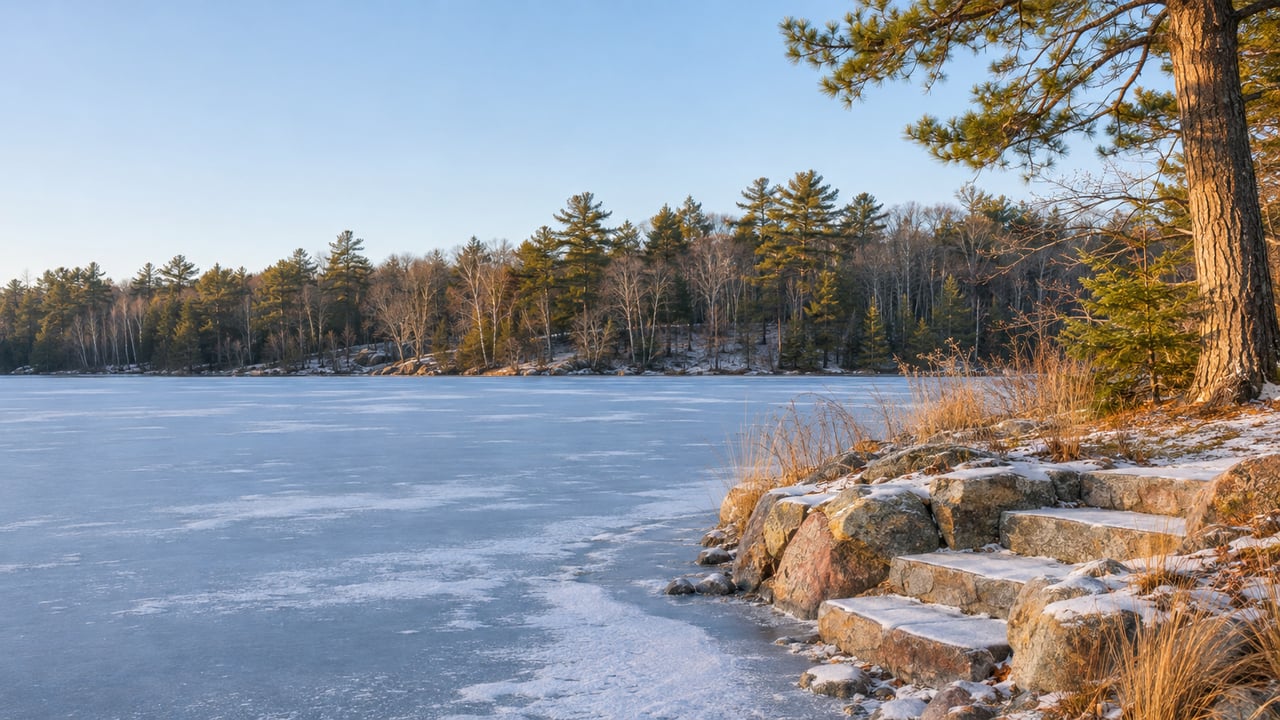
A December showing on the Whitefish Chain starts at the shoreline, and in December the shoreline is a flat white field. The dock sections are stacked on the bank. The boat lift is up on blocks or gone to storage. Nothing tells you whether the water off that frontage is four feet deep or fourteen, sand or muck, open or thick with weeds by July. The seller's summer photos show a sunny afternoon, and they can't answer any of those questions.
Shopping the chain in winter means giving up that view. In return, a buyer gets a slower fall market, and most of what the ice covers can be checked lake by lake in public records.
The listings still standing at ice-in
The latest county numbers describe the market a winter buyer walks into. The Minnesota REALTORS local market update for Crow Wing County shows homes that sold in October 2026 took a median 59 days to sell, up from 44 days in October 2025. Sellers who closed in October 2026 received 93.7 percent of their original list price, down from 95.2 percent in October 2025. New listings for October 2026 were 113, against 120 a year earlier, and months of supply was 4.4, against 4.6.
Two cautions apply to these figures. They cover all of Crow Wing County, not only lakeshore, and the report itself warns that a single month can look extreme because the sample is small. The year-to-date numbers point the same way, though more gently. Through October 2026, median days on market was 56, compared with 48 through October 2025, and sellers received 96.3 percent of original list price, compared with 96.6 percent.
Homes across the county are taking longer to sell than they did a year ago, and the county's fall sellers have been accepting more distance from their opening price than they did a year ago. The tradeoff is choice, because fewer new listings came on in October than the year before. A winter buyer gets fewer options and more room to negotiate. That room only pays off if the frozen shoreline doesn't scare you into a discount you didn't need or a purchase you'd regret, so the rest of this post covers how to see under the ice.
Water depth is already mapped
Every major lake on the chain has a Minnesota DNR LakeFinder page with a link to a DNR lake depth map and to University of Minnesota water clarity information. That covers Cross Lake Reservoir, Rush, Big Trout, Pig, Daggett, Clamshell, Bertha, Lower Hay, Upper Hay, Whitefish, Island, Loon and Arrowhead. The DNR notes on its LakeFinder home page that not every Minnesota lake has been surveyed or depth-sounded. On this chain, the depth maps are there.
A contour map won't tell you the depth at the end of one particular dock. It will show whether a lot faces a shallow flat or a drop-off, and that difference shapes how long a dock has to be, where a lift can sit, and what kind of boat the frontage can handle. A buyer can learn all of that in January with a parcel address and the right lake page open. The lake itself matters as much as the lot, which is the argument behind our earlier post, The Whitefish Chain Isn't One Market. It's Thirteen.
The weeds have their own paperwork
Summer weed growth is what the ice hides most completely, and the chain's records on it are uneven. LakeFinder links vegetation reports for Cross Lake Reservoir, Rush, Pig, Daggett, Clamshell, Bertha, Lower Hay and Arrowhead. Big Trout, Lower Hay and Whitefish also link aquatic plant survey documents. Island and Loon share one combined Island-Loon vegetation report. The Upper Hay page has no vegetation report link.
That gap affects how you shop. On most of the chain, a winter buyer can read a plant survey and get a reasonable sense of what grows along the shallows in summer. On Upper Hay, a buyer is relying more on the seller, the neighbors and a return visit after ice-out, and the offer can be timed with that in mind.
Zebra mussels are a known, dated fact on every lake
Every one of those thirteen LakeFinder pages lists zebra mussels. The DNR's infested waters list, dated October 21, 2026, records zebra mussels in Cross Lake, Big Trout and Daggett as first confirmed in 2013 and listed in 2014. Bertha was listed in 2014 and confirmed in 2017. Clamshell and Arrowhead are on the list because they connect to the Whitefish Chain.
Zebra mussels have been part of owning on this chain for more than a decade, so a winter buyer isn't missing anything a summer buyer would discover. Prices on the chain have formed with that fact on the record for years.
Starry stonewort in the Rush Lake Channel
Starry stonewort is the newer item on the record, and it has a local story behind it. The DNR confirmed it on September 5, 2024, in the channel between Rush and Lower Whitefish lakes, according to the Whitefish Area Property Owners Association. MPR News reported that it was the first time the invasive algae had been detected on the chain. The association responded with advice from the DNR and the University of Minnesota's Aquatic Invasive Species Research Center: it closed off the area with a silt fence, had divers pull the algae by hand, and treated the site with an algaecide.
In June 2025, the Pine and Lakes Echo Journal reported to Crosslake readers that surveys had found little visible growth, but the plant's reproductive bulbils were still in the Rush Lake sediment. On October 9, 2025, DNR and volunteer divers went back to the channel and collected vegetation in mesh bags, and volunteers in rowboats brought the bags to shore for analysis and disposal. Tony Coffey, president of the association, told MPR News that "it's really laid back," and that the expected fall growth had not appeared. Michael Duncan, the volunteer leading the effort, told MPR, "We know that we haven't eradicated it." MPR also reported that the 2025 surveys had found no additional infested areas at the time of its story.
The association's current site says starry stonewort is still confirmed in the Rush Lake Channel and that its underwater ROV supports monitoring, including under the ice. Under-ice monitoring by the people who live here doesn't stop at freeze-up, and that matters to a buyer looking at frontage near the Rush and Lower Whitefish connection. The association has also run water quality monitoring on more than 35 area lakes for years, along with water-access inspections and a shoreline restoration program, as described on its mission page. Membership in a group like this tells you who you'll be sharing the water with.
The dock is the one thing you have to take on faith, briefly
The dock and the boat lift are what a winter buyer truly can't inspect in place. Crosslake has several seasonal installers whose business is taking docks and lifts out in fall and putting them back in spring. Lake Area Docks & Lifts has a Crosslake store, serves Crosslake and the Whitefish Chain, and handles dock and lift installation and removal. Waterfront Services Inc. serves the Crosslake area and lists spring dock and lift installation and fall removal among its seasonal work. Rock Solid Dock & Lift has a Crosslake location and installs, removes, repairs and stores docks and lifts. Lakeside Simplicity covers the Whitefish Chain with seasonal dock and lift placement.
A dock that comes out every fall usually has an installer who knows it. A winter buyer can ask the seller which company handles the dock and lift, then ask that company what's stored, what condition it's in, and where it goes in. A pile of sections on the bank can't tell you much, and the installer can.
The DNR's ice-out page keeps historical dates by lake, and it warns that an ice-out date says nothing about ice thickness. Ice-out is the date that decides when you'll see the frontage with open water. If you buy in winter, you'll be looking at the shoreline for the first time as an owner, unless the purchase timeline leaves a window after ice-out.
What's left after the records
Take away the depth map, the plant survey, the infested waters list, the Rush Lake Channel story and the installer's account of the dock, and a short list remains. You still can't see how much boat traffic passes the frontage on a July Saturday, or exactly what the bottom feels like underfoot at the end of the dock. Those are real unknowns. They are a smaller set than the white expanse at a December showing suggests, and the county's October 2026 numbers show sellers accepting more distance from their original price than they did a year ago.
If you're comparing lakes before you compare houses, the Whitefish Chain neighborhood page is a good place to start. If you're already writing an offer, our post on the septic clock that starts after closing covers the other thing you can't see from the driveway.
A few questions we hear in winter
Which Whitefish Chain lake has the least published information about summer conditions? Upper Hay. Its LakeFinder page links a depth map and clarity data but no vegetation report.
Is starry stonewort on lakes other than Rush? As of MPR News's October 2025 report, the 2025 surveys had found no additional infested areas beyond the Rush Lake Channel, and the association's current site still lists it as confirmed in that channel.
Do the October numbers describe lake homes specifically? No. The Minnesota REALTORS report covers all of Crow Wing County. It shows the direction of the fall market and doesn't give a lakeshore-only figure.
We're glad to put together a lake-by-lake file for any frozen frontage you're considering, from the depth map to the installer who knows the dock. Reach out to the Pederson Team to schedule a Lakeside Consultation before ice-out.